Alumni

Bio
Pragyna Naik is a rising junior at Corvallis High School in Corvallis, Oregon. She knows Python and Java, and she is very excited to learn Mathematica. Pragyna loves programming, but some of her other hobbies include tennis, dance, debate and watching TV. She dreams of living in New York one day, and although she has yet to decide her true profession, she knows it will involve programming.
Project: Using the Dominant Colors of Geotagged Photos on Flickr to Color Maps
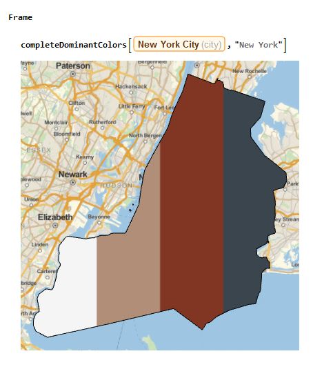
As cameras, photos and selfies are becoming a more prominent part of all of our lives, I proposed this idea to use the geotags from Flickr photos and find their dominant colors. Then those dominant colors would be used to color a map based on the location of the geotag.
Flickr is a photo-sharing website where people can upload all kinds of photos, from pictures of themselves to pictures of important world places. Unfortunately, because of the variety of Flickr photos, many photos simply don't represent the area they are geotagged in. At first, I tried to use the keyword "landscape" in order to filter out the photos, but many cities and places didn't have pictures that were connected with this word. In the end, I decided that having more pictures would be more useful than trying to find fewer pictures and having fewer places to extract data from.
One thing I was able to do was to extract any very dark colors from the dominant colors list since, in most cases, dark colors are just shadowy parts of the picture and generally don't represent the true colors of the image and the area in which they are taken. I did this by using the code DeleteCases[Flatten[newPictures],color_/;Mean[List@@color]<0.2].
In the end, this project is able to extract the four most prominent colors in a city based upon Flickr photos that were geotagged using the city location. Some areas do tend to work better than others, as many places simply don't have Flickr photos geotagged to their locations. If a certain place doesn't have any photos avaliable, an error will occur.